
Photogrammetry Surveys in Oxfordshire
Get in TouchAt Aerotech Imaging, we provide detailed photogrammetry surveys in Oxfordshire that use advanced aerial imaging techniques. Our surveys help create precise topographical maps and 3D models, addressing the needs of architects, engineers, and planners.
We cover a wide range of applications, from land surveying to large-scale construction projects. Operating across OX14 3, Aerotech Imaging is your trusted partner for reliable and efficient mapping solutions.
Get in touch with us today to discuss your project requirements.
Book Photogrammetry Surveys Today
How Much Do Photogrammetry Surveys Cost in Oxfordshire?
Photogrammetry surveys typically cost between £500 and £2,000 per job in Oxfordshire, depending on the project's complexity and area size. At Aerotech Imaging, we tailor our services to meet specific client needs, ensuring accuracy and efficiency.
The equipment we use, such as drones equipped with high-resolution cameras, plays a significant role in determining the final cost. Additionally, the surveys may require post-processing software like Pix4D or Agisoft Metashape to generate precise 3D models and topographical maps, which can affect pricing.
Costs are also influenced by factors such as the terrain, required resolution, and data processing time. Projects involving dense urban areas or difficult terrains may require additional flight time and data points.
The project timeline is another consideration, as expedited services can incur higher fees. Contact us for a detailed quote based on your project's specifications.
What Types of Photogrammetry Surveys Are Available in Oxfordshire?
We offer various types of photogrammetry surveys in Oxfordshire to suit different project needs. Our services are designed to meet the specific requirements of diverse sectors, using precise measurement and imaging techniques:
Aerial Photogrammetry: Ideal for large-scale projects, capturing wide-area images quickly. This method uses fixed-wing aircraft or drones equipped with calibrated cameras to map topographic surveys, infrastructure development, and environmental monitoring.
Terrestrial Photogrammetry: Used for detailed building surveys and smaller areas, employing ground-based camera stations to create accurate 3D models of building exteriors and facades. It's particularly effective for heritage conservation and urban planning initiatives.
Close-range Photogrammetry: Suitable for examining structures and archaeological sites, using digital cameras and specialised software to produce high-resolution models for structural analysis or artefact reconstruction.
Each type provides unique benefits, with applications across multiple industries, including construction, archaeology, and environmental studies. Contact us to determine which method is best for your project.
How Do Photogrammetry Surveys Work?
Photogrammetry surveys follow a systematic process that involves several meticulous stages to ensure the accuracy and detail of the final output:
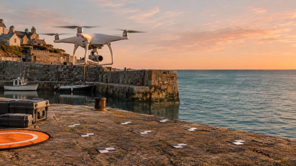
Planning: We determine the project scope by assessing the area size and specific client requirements. This stage includes selecting appropriate equipment like DJI Phantom drones or Nikon DSLR cameras and planning flight paths or arranging ground image positioning to ensure coverage.
Data Collection: Using drones equipped with GPS systems or stationary cameras, we capture high-resolution images from multiple angles. Our drones can fly at altitudes up to 120 metres, enabling us to gather detailed data over larger expanses, while stationary cameras are used for more focused areas.
Processing: We use specialised software such as Agisoft Metashape or Pix4D to convert these images into detailed 3D maps or models. The processing involves stitching images together and applying georeferencing to align the data with real-world coordinates.
Delivery: We provide the final deliverables in formats such as orthophotos or digital elevation models, tailored to suit architectural, engineering, or environmental projects.
This method ensures precision and comprehensiveness, making it ideal for industries ranging from construction to environmental management. Contact us to discuss how photogrammetry can benefit your project in Oxfordshire.
What Are the Benefits of Photogrammetry Surveys in Oxfordshire?
Photogrammetry surveys in Oxfordshire offer numerous advantages by employing aerial and ground-based imaging to create detailed 3D models and maps. Using high-resolution cameras mounted on UAVs (Unmanned Aerial Vehicles), we can cover large areas rapidly, ensuring faster data collection compared to traditional methods such as total stations or manual surveying.
This technology reduces the need for extensive on-site manpower, as much of the data processing and analysis can be done remotely.
Photogrammetry's adaptability to various environments and project types is outstanding, working effectively across urban areas, rural landscapes, and industrial sites. It complies with standards like the RICS 'Measured Surveys of Land, Buildings and Utilities', providing confidence in data reliability.
This method is particularly suitable for clients involved in environmental assessments, construction planning, and infrastructural development who require accurate and detailed spatial information. These benefits make photogrammetry an ideal choice for efficient and precise surveying.
Contact us to learn how our photogrammetry surveys can benefit your project.
Speak to a Photogrammetry Surveys Expert
When Are Photogrammetry Surveys Needed in Oxfordshire?
Photogrammetry surveys are essential in Oxfordshire for scenarios such as:
Infrastructure development and planning: We provide highly detailed 3D models and topographical maps that aid in the design and analysis of bridges, roads, and railways, ensuring precise alignment and structural integrity.
Environmental monitoring and impact assessments: Our surveys help track changes in ecosystems over time, assess habitat degradation, and support compliance with environmental regulations by using multispectral imaging to capture data not visible to the naked eye.
Mineral exploration and agricultural analysis: We offer remote sensing capabilities for identifying mineral compositions and assessing crop health, optimising yield via NDVI (Normalised Difference Vegetation Index) analysis and spectral data.
Urban planning and construction design: Our photogrammetric data supports city planners with accurate building measurements and site evaluations, adhering to local planning regulations and improving space utilisation.
Our team at Aerotech Imaging is equipped to support a diverse range of projects. Let us assist you in achieving precise and reliable results for your photogrammetry needs.
Why Choose Aerotech Imaging for Photogrammetry Surveys in Oxfordshire?
Choosing Aerotech Imaging for photogrammetry surveys in Oxfordshire ensures you receive expert services tailored to your needs. We use advanced methods like Structure from Motion (SfM) and Aerial Triangulation to generate precise 3D models from aerial imagery.
Our team operates Unmanned Aerial Vehicles (UAVs) equipped with sophisticated sensors, ensuring high-resolution image capture. We use industry-standard software such as Pix4D and Agisoft Metashape, which allow us to deliver results that meet rigorous accuracy requirements, conforming to RICS and ISO standards.
We support a wide range of projects, from land development and infrastructure planning to heritage site preservation. With a focus on customer satisfaction and project success, our team works diligently to meet your specific project timelines.
Serving the OX14 3 area, we are ready to assist you in achieving your surveying goals.
Frequently Asked Questions
How long does it take to complete a photogrammetry survey?
Most photogrammetry surveys in Oxfordshire are completed within two to five days, depending on the project's size and complexity.
Is photogrammetry suitable for small projects?
Yes, photogrammetry can be applied to both small and large projects, offering scalable solutions for diverse surveying needs.
What equipment does Aerotech Imaging use for surveys?
We use drones and cameras equipped with high-resolution sensors to capture precise data for accurate mapping.
How accurate are photogrammetry surveys?
Our photogrammetry surveys achieve accuracy levels within centimetres, ensuring high fidelity in the resulting maps and models.
Do I need permission for aerial imaging in Oxfordshire?
Permission may be required depending on the location and specific project needs. We can advise you on permissions as part of our service.
Get a Free Quote for Photogrammetry Surveys in Oxfordshire
Contact Aerotech Imaging today to discuss your project and receive a free, no-obligation quote. Our team is ready to assist you with all your photogrammetry survey needs in Oxfordshire.
We cover Oxfordshire