
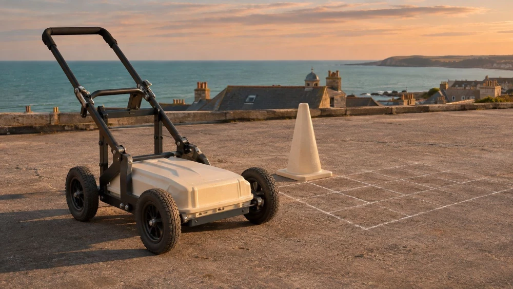
GPR Surveys in Warwickshire
Get in TouchAt Aerotech Imaging, we specialise in providing expert GPR surveys in Warwickshire. Ground Penetrating Radar (GPR) is a versatile and non-intrusive geophysical method used to detect subsurface structures.
Our skilled team uses advanced radar technology to identify features such as utilities, voids, and buried objects effectively. GPR surveys are suitable for a wide range of applications including archaeology, construction, and infrastructure projects.
We are committed to serving clients throughout CV9 1 and beyond. Contact us today to discuss your specific requirements.
How Much Do GPR Surveys Cost in Warwickshire?
GPR surveys typically cost between £500 and £1,500 per day in Warwickshire, depending on the project's scope and specifics. Factors influencing the cost include the survey area size, site conditions, and the depth of investigation required.
The equipment used, such as antennas with different frequency ranges, can also impact costs. Lower frequency antennas penetrate deeper but provide less detail, while higher frequencies offer more detailed surface information.
The site’s accessibility and any necessary permissions or safety measures, such as traffic management, can further affect pricing. Compliance with standards like PAS 128 for utility detection might be required for some projects, adding to the cost considerations.
At Aerotech Imaging, we ensure that our pricing is competitive and transparent, providing a detailed quote tailored to your project's needs. For accurate pricing, get in touch with us to discuss your requirements today.
What Are the Benefits of GPR Surveys in Warwickshire?
At Aerotech Imaging, we offer GPR surveys in Warwickshire that provide numerous benefits. This method is non-destructive and offers high-resolution subsurface images, making it invaluable for various applications.
Using advanced radar pulses, GPR can penetrate concrete, soil, and other materials to a depth of up to 10 metres, depending on the soil's conductivity and moisture content.
Non-Intrusive: GPR does not damage the surveyed area, preserving surfaces like pavements and floors.
Versatile Applications: Useful for construction, archaeology, environmental projects, and utility mapping, helping to locate rebar, voids, and pipelines.
High Precision: Accurately locates utilities and other subsurface features, complying with UK standards for surveying and excavation.
Quick Results: Provides immediate feedback, allowing for efficient decision-making and reducing project delays.
Contact us to find out how our GPR surveys can benefit your project in Warwickshire.
How Long Do GPR Surveys Take?
Most GPR surveys are completed within one to three days, depending on the survey size and complexity. We start by considering the layout and accessibility of the site, as well as the specific requirements of the project such as penetration depths and data resolution needs.
Our experienced team works efficiently to provide comprehensive surveys without compromising on quality. Using precision equipment like multi-channel GPR systems, we collect high-resolution data to facilitate detailed subsurface mapping.
We ensure minimal disruption to your project timelines, coordinating effectively with other site activities. Our technology allows immediate data interpretation and integration with CAD and GIS systems, expediting the decision-making process.
Additionally, our surveys adhere to relevant standards such as PAS 128, ensuring reliable and repeatable results. For an accurate estimate of your project's duration, get in touch with our team.
How Does GPR Work?
GPR uses radar pulses to image the subsurface by sending high-frequency radio waves into the ground and recording the reflected signals from the subsurface structures. These waves can penetrate various materials such as soil, concrete, and rock, making GPR versatile for different environments.
Signal Transmission: A radar antenna, mounted on a cart or sled, sends out radio waves, typically ranging from 10 MHz to 2.6 GHz, depending on the required depth and resolution.
Signal Reflection: Waves reflect off subsurface objects like cables, pipes, and voids and return to the surface, providing data on their depth and composition.
Data Interpretation: Reflected signals are processed using specialised software to create a visual representation, often cross-referenced with utility maps for increased accuracy.
Our team at Aerotech Imaging expertly analyses these results to provide clear insights, determining factors like depth, material type, and potential hazards, helping you make informed decisions for your project in Warwickshire.
Why Choose Aerotech Imaging for GPR Surveys in Warwickshire?
Aerotech Imaging is your trusted partner for GPR surveys in Warwickshire. We use the latest ground penetrating radar technology, including equipment from industry leaders such as GSSI and Mala, to map subsurface features with precision.
Our skilled team is trained in various techniques, including concrete scanning and utilities mapping, ensuring precise and reliable results for every survey. We adhere to the highest standards, following guidelines set by the British Standards Institution (BSI) for non-destructive testing.
Our services are tailored to meet the unique needs of each client, whether you're a construction manager requiring pre-excavation surveys or a historical conservationist assessing heritage sites. We pride ourselves on our customer-focused approach, providing accurate reports that identify potential hazards or obstructions.
Covering Warwickshire and the surrounding CV9 1 postcode area, we are ready to assist with your GPR survey needs. Reach out to us to learn more about our services and how we can support your project.
Frequently Asked Questions
How Do I Maintain the Equipment After a GPR Survey?
After a GPR survey, our team ensures all equipment is cleaned and stored correctly, maintaining functionality for future use. You don’t need to worry about maintenance as this is fully managed by our experts.
Is GPR Suitable for Detecting All Subsurface Features?
GPR is effective for most non-metallic materials like voids, rock, soil, concrete, and asphalt. Some materials with high conductivity may limit its effectiveness.
What Guarantee Comes with a GPR Survey?
We guarantee detailed reports and accurate findings from every GPR survey. Our customers rely on our expertise for reliable results and actionable insights.
Can GPR Surveys Be Conducted in Wet Conditions?
Yes, GPR surveys can be conducted in wet conditions, though waterlogged soil may affect the radar waves' effectiveness. We plan surveys carefully to mitigate such issues.
Which Areas Do You Cover for GPR Surveys?
We primarily cover Warwickshire and the surrounding CV9 1 area, though we are equipped to handle projects nationwide. Contact us if your project is outside this range.
Get a Free Quote for GPR Surveys in Warwickshire
Contact Aerotech Imaging today to request your free quote for GPR surveys in Warwickshire. Our team is ready to discuss your needs and provide expert guidance.
We cover Warwickshire